27 Years of Excellence
Government Licence: 396

Spantik Expedition

Spantik Peak Expedition (7,027-M)
View from summit of Spantik Peak
Spantik Expedition (7,027-M)
Spantik Peak Expedition (7,027-M)
View from summit of Spantik Peak
Spantik 7027m
Spantik Expedition (7,027-M)
previous arrow
next arrow

Spantik/Golden Peak (7027-M)


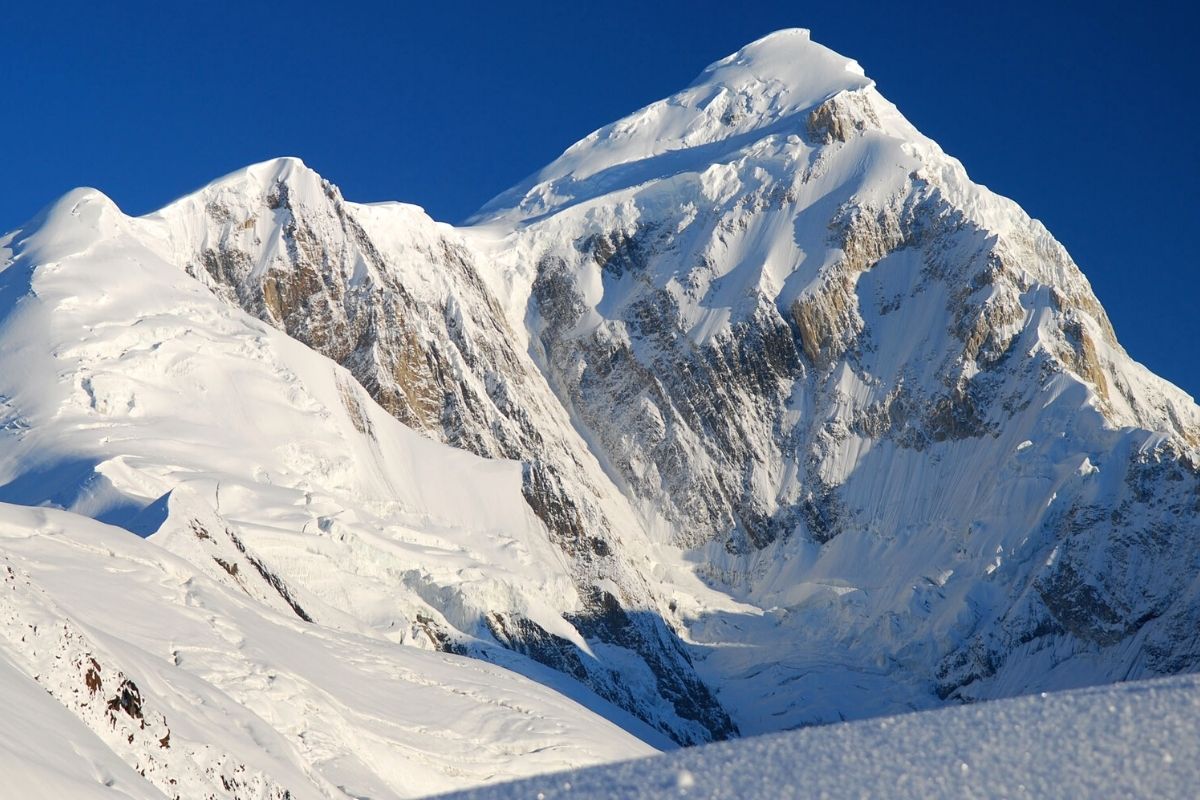
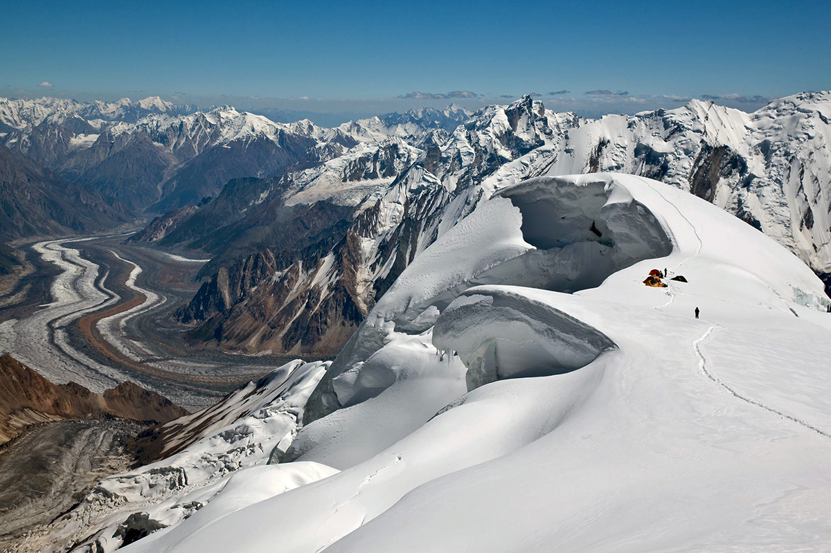
Speaking of Spantik, at 7,027 meters, is essentially speaking of a three-in-one mountain. Climbing to Camps 2 and 3 is an experience in itself, as each camp is situated on a mini-summit of the South-East Ridge, offering a breathtaking 360-degree panoramic view.

Difficulty Level: The success of such an adventure, apart from weather conditions, relies on the physical condition of each participant and their indispensable experience in high-altitude mountaineering. Roped parties should be self-sufficient, even though we provide equipment and assist with the main glacier difficulties (45/50 degrees) with fixed ropes. Participants are expected to contribute as much as possible to the setup of equipment. This expedition is for mountaineers experienced in independent roped parties, navigating snow and glaciers at the AD Level. High-altitude experience is required, such as climbing any 6,000-meter peak. Excellent physical condition and regular practice are necessary to fully enjoy this exceptional journey. Challenges at high altitude include isolation, lack of oxygen, cold temperatures, blizzards, and more.

Over the course of the following 18 days, our singular objective will be to summit Spantik. For this purpose, we will establish three high-altitude camps:

Camp I at approximately 4,450 meters, accessible via a less rugged path but situated farther from the base camp (we ascend to the origin of the Chogolungma glacier, about 8 km from the base). Camp II at 5,300 meters, and Camp III at 6,050 meters.

Certain sections of the route between camps will be equipped with fixed ropes for safety during travel. Ascending to Camps 2 and 3 offers spectacular vistas, as each camp is perched on a mini-summit of the southeastern ridge, providing a 360-degree view. The distribution of collective tasks for high-altitude camps will involve rotation among mountaineers, the team, and the guide(s). From Camp 3, there remains a 950-meter ascent to the summit, to be covered within one day. Traveling between camps aids in acclimatization, a crucial factor for success in most cases. Dismantling of camps will also be a collective effort, guided by the expedition leader.

Spantik Expedition- Dates & Cost

SPANTIK EXPEDITION  Cost (USD)Cost (EUR)
Spantik Expedition (28 Days) – Group Price US$ 3,365€ 3,245
Spantik Expedition (30 Days)- Group PriceUS$ 3,475€ 3,315
Start Dates End Dates Deposit Availability Register
02-July 31-July US$ 500 Available 
01-August 30-August US$ 500 Available 

Detailed Itinerary Spantik Expedition

Welcome at Islamabad airport and transfer to hotel. Afternoon proceed for city tour of Islamabad and Rawalpindi, which includes famous Faisal Mosque, Shakar Parian, Pakistan monument, Damen Koh, Lok Versa, Museum, Rawalpindi old bazaar, Raja Bazaar.

Altitude: 540 m.
Accommodation: Hotel
Meals: Breakfast, Lunch, Dinner

Drive to Naran 6-7 hours 239 km, after lunch continue drive to Chilas 3-4 hours 113.3 km via Babusar Pass 4,173 m.
Babusar Pass is a high mountain pass at an elevation of 4,173 m (13,691 ft) above the sea level. The pass is the highest point in the Kaghan Valley, Pakistan. The pass connects the Kaghan Valley via the Thak Nala with Chilas on the Karakorum Highway. It’s one of the famous hair pinned roads in the world.

Altitude: 1,265m.
Accommodation: Hotel
Meals: Breakfast, Lunch, Dinner

Drive to Skardu along with Indus River 8-9 hours, 290 km. En-route stop at junction point of three great mountain ranges meet, the Karakorum, Himalaya and Hindukush and stop at Thalichi for photography from Nanga Parbat 8,126 m.

Altitude: 2,228 m.
Accommodation: Hotel
Meals: Breakfast, Lunch, Dinner

Today we take the spectacular drive by jeeps to Aarandu. Arandu is last village and starting point of our trek.

Altitude: 2,770m
Accommodation: Camping
Meals: Breakfast, Lunch, Dinner

Trek from Arandu to Chogo Brangsa 6-7 hours.

Altitude: 3,322m
Accommodation: Camping
Meals: Breakfast, Lunch, Dinner

Trek to from Chogo Brangsa to Bolocho camp 5-6 hours.

Altitude: 3,800m
Accommodation: Camping
Meals: Breakfast, Lunch, Dinner

Trek to Spantik base camp 5-6 hours.

Altitude: 4,300m
Accommodation: Camping
Meals: Breakfast, Lunch, Dinner

17 days for climbing Spantik 7027 m.

Accommodation: Camping
Meals: Breakfast, Lunch, Dinner

Trek down to Bolocho 4-5 hours.

Altitude: 3,800m
Accommodation: Camping
Meals: Breakfast, Lunch, Dinner

Trek down to Arandu 4-5 hours.

Altitude: 2,770m
Accommodation: Camping
Meals: Breakfast, Lunch, Dinner

Drive back to Skardu 6-7 hours.

Altitude: 2,228m
Accommodation: Hotel
Meals: Breakfast, Lunch, Dinner

We fly back to Islamabad. Afternoon is free for exploring.
Note: If our flight is cancelled due to bad weather, we will start the drive to Islamabad travelling for 9 hours along with Indus River to reach Chilas.

Altitude: 540m
Accommodation: Hotel
Meals: Breakfast, Lunch, Dinner

Enjoy a free day in Islamabad for exploring, sightseeing and shopping.
Note: If our flight on day 28 cancelled we will spend 11-12 hours driving from Chilas to Islamabad via Babusar Pass 4173 m.

Altitude: 540m
Accommodation: Hotel
Meals: Breakfast, Lunch, Dinner

Transfer to Islamabad airport for return flight.

Diran Peak Expedition

Diran Peak Expedition
Base Camp of Diran Peak
Diran Peak Expedition
Base Camp of Diran Peak
previous arrow
next arrow

Diran Peak 7266-M


Diran Peak, rising to an elevation of 7,266 meters 23,839 feet, is located in the Karakoram range of Gilgit- Baltistan. Pak It’s one of the most iconic and visually striking peaks in the region. Diran Peak is known for its pyramid-shaped summit, making it a coveted destination for mountaineers and adventurers.

Diran peak 7266m was first climbed in 1968 by three Austrians Rainer Goeschl, Rudolph Pischinger, and Hanns Schell. Earlier attempts by a German expedition in 1959 and an Australian expedition in 1964 were unsuccessful.

The peak presents a significant challenge to climbers due to its technical difficulty and unpredictable weather conditions. Despite its allure, Diran Peak has also earned a reputation for its hazards, including avalanches and crevasses.

Diran Peak is surrounded by stunning landscapes, including glaciers, alpine meadows, and rocky terrain, offering adventurers a truly unforgettable experience.

Dates & Cost- Diran Peak Expedition

Diran Peak EXPEDITION Cost (USD)Cost (EUR)
Diran Peak Expedition 30 Days) – Group PriceUS$ 2,950€ 2,780
Diran Peak Expedition (34 Days) – Group PriceUS$ 3,220€ 3,070
Start DatesEnd DatesDepositAvailabilityRegister
01-July30-JulyUS$ 500 Available 
25-July27-AugustUS$ 500 Available 

Detailed Itinerary Diran Peak Expedition

Welcome at Islamabad airport and transfer to hotel. Afternoon proceed for city tour of Islamabad and Rawalpindi, which includes famous Faisal Mosque, Shakar Parian, Pakistan monument, Damen Koh, Lok Versa, Museum, Rawalpindi old bazaar, Raja Bazaar.

Altitude: 540m
Accommodation: Hotel
Meals: Breakfast, Lunch, Dinner

Drive to Naran 6-7 hours 239 km, after lunch continue drive to Chilas 3-4 hours 113.3 km via Babusar Pass 4,173 m.
Babusar Pass is a high mountain pass at an elevation of 4,173 m (13,691 ft) above the sea level. The pass is the highest point in the Kaghan Valley, Pakistan. The pass connects the Kaghan Valley via the Thak Nala with Chilas on the Karakorum Highway. It’s one of the famous hair pinned roads in the world.

Altitude: 1,265m
Accommodation: Hotel
Meals: Breakfast, Lunch, Dinner

Drive to Minapin 6-7 hours. 200 km. En-route stop at junction point of three great mountain ranges meet, the Karakorum, Himalaya and Hindukush, at Thalichi for photography from Nanga Parbat 8,126 m and at Rakaposhi view point for photography and refreshment.

Altitude: 2,012m
Accommodation: Hotel 
Meals: Breakfast, Lunch, Dinner

Trek from Minapin village to Hapakun hours.
The trail begins behind the Minapin village, cross a bridge to the Minapin River’s true left bank. The step path gives wide views of the Minapin Glacier, and eventually of the entire Rakaposhi-Diran crest line.

Altitude: 2,804m
Accommodation: Camping
Meals: Breakfast, Lunch, Dinner

Trek to Tagaphari (Rakaposhi base camp 3-4 hours), 3 km, after lunch continue trek to Diran Peak base camp.
Ascend a trail through forest with excellent views of Diran as you rise above the Minapin glacier. There is lush green Tagaphari meadow also summer huts with shepherds just overlooking the glacier’s supper ice fields.

Altitude: 3,650m
Accommodation: Camping
Meals: Breakfast, Lunch, Dinner

22 days in Diran Peak base camp for climbing.

Accommodation: Camping
Meals: Breakfast, Lunch, Dinner

Trek back to Rakaposhi base camp, after lunch continue trek down to Hapakun camp.

Altitude: 2,804m
Accommodation: Camping
Meals: Breakfast, Lunch, Dinner

Trek down to Minapin 4 hours and drive to Karimabad. After refreshment local visits in Karimabad.

Altitude: 2,500m
Accommodation: Hotel
Meals: Breakfast, Lunch, Dinner

Drive to Naran 355 km via Babusar Pass 4173 m. En-route stop at various viewpoints for photography and refreshment.

Altitude: 2,409m
Accommodation: Hotel
Meals: Breakfast, Lunch, Dinner

Drive from Naran to Islamabad 5-6 hours, en-route visit Taxila museum and historical sites.

Accommodation: Hotel:
Meals: Breakfast, Lunch, Dinner

Transfer to Islamabad airport for return flight.

Passu Peak Expedition

Passu Peak Expedition (7,284-M)
Passu Peak base Camp
Passu Peak Climbing
Passu Peak 7284m
Passu Peak Expedition (7,284-M)
Passu Peak base Camp
Passu Peak Climbing
Passu Peak 7284m
previous arrow
next arrow
Passu Peak Expedition
 

The best time for climbing Passu Peak is from June to September.

Passu Sar or Passu Peak, standing at 7,284 meters, is a mountain peak located in the Batura Muztagh, a sub-range of the Karakoram mountain range. It is situated in the Gilgit District of the Northern Areas of Pakistan, to the west of the Hunza Valley. Passu Peak marks the highest point of the Passu massif, which also includes Passu Diar (or “Passu East”, “Pasu II”). Positioned on the main ridge of the Batura Muztagh, Passu Peak is approximately 7 kilometers (4 miles) east of Batura Sar.

The first successful ascent of Passu Peak occurred on August 7, 1994, by Max Wallner, Dirk Naumann, Ralf Lehmann, and Volker Wurnig.

The route from base camp to camp 1 traverses many ice walls and crevasses, particularly in proximity to camp 1. From advanced base camp (ABC) to camp 1, professional and experienced climbers must carefully navigate to find the exact route and secure ropes for the remaining team members. This process can be time-consuming due to the need to navigate through ice walls and crevasses. A minimum of 500 to 700 meters of rope (depending on group size), ice screws, snow tubes, and other necessary equipment is required. Climbers must be roped together for safety. It is advisable to carry two ladders in case crevasses widen during the ascent.

Dates & Cost- Passu Peak Expedition
PASSU PEAK EXPEDITION Cost (USD)Cost (EUR)
Passu Peak Expedition (30 Days) – US$ 3,270€ 3,100
Passu Peak Expedition (32 Days) – US$ 3,350€ 3,180
Start DatesEnd DatesDepositAvailabilityRegister
25-June24-JulyUS$ 500 Available 
10-July10-AugustUS$ 500 Available 
Detailed Itinerary Passu Peak Expedition

Welcome at Islamabad airport and transfer to hotel. Afternoon proceed for city tour of Islamabad and Rawalpindi, which includes famous Faisal Mosque, Shakar Parian, Pakistan monument, Damen Koh, Lok Versa, Museum, Rawalpindi old bazaar, Raja Bazaar.

Altitude: 540m.
Accommodation: Hotel
Meals: Breakfast, Lunch, Dinner

Drive to Naran 6-7 hours 239 km, after lunch continue drive to Chilas 3-4 hours 113.3 km via Babusar Pass 4,173 m.
Babusar Pass is a high mountain pass at an elevation of 4,173 m (13,691 ft) above the sea level. The pass is the highest point in the Kaghan Valley, Pakistan. The pass connects the Kaghan Valley via the Thak Nala with Chilas on the Karakorum Highway. It’s one of the famous hair pinned roads in the world.

Altitude: 1,265m.
Accommodation: Hotel
Meals: Breakfast, Lunch, Dinner

Drive to Karimabad (Hunza) 5-6 hours 240 km. En-route stop at junction point of three great mountain ranges meet, the Karakorum, Himalaya and Hindukush, at Thalichi for photography from Nanga Parbat 8,126 m and at Rakaposhi view point for photography and refreshment.

Altitude: 2,500m
Accommodation: Hotel
Meals: Breakfast, Lunch, Dinner

Drive to Borith Lake 1 hour and meet porter and trek to Luzdher 3-4 hours.
Today we cross Passu white glacier, with sections of some crevasses in beginning and end also huge boulders. Luzdher camp is at the base of Patundas meadows; while cross Passu glacier especially in the beginning and at the end our valued clients has to be rope up just for safety precautions. There are no crevasses in the middle of the glacier. Have a nice view of Passu peak, Shishper peak, Ultar SAR and Popdan peak.

Altitude: 3.660m
Accommodation: Camping
Meals: Breakfast, Lunch, Dinner

Trek to Patundas Pass 4-5 hours.
Steep trek to Patundas, a meadow at the crest of a small hill, this brings you the fascinating area of upper Hunza. The highlight being Patundas Meadows 4575 m. A vantage point, which offers views of an ocean of peaks: Shisper 7611 m, Dastagil SAR 7785 m, Momhil SAR 7343 m, Rakaposhi 7788 m and many more.

Altitude: 4,100m
Accommodation: Camping
Meals: Breakfast, Lunch, Dinner

Trek from Patundas Pass to Passu Peak base camp 4 hours.

Accommodation: Camping
Meals: Breakfast, Lunch, Dinner

20 days in Passu Peak base camp for climbing.

Accommodation: Camping
Meals: Breakfast, Lunch, Dinner

Trek down to Patundas Das Pass and continue trek to Luzdhur.

Altitude: 3,660m
Accommodation: Camping
Meals: Breakfast, Lunch, Dinner

Trek down to Passugar.

Altitude: 3,200m
Accommodation: Camping:
Meals: Breakfast, Lunch, Dinner

Trek to Borith Lake and drive to Karimabad via Attabad lake.

Altitude: 2,500m
Accommodation: Hotel
Meals: Breakfast, Lunch, Dinner

Drive to Naran 355 km via Babusar Pass 4173 m. En-route stop at various viewpoints for photography and refreshment.

Altitude: 2,409m
Accommodation: Hotel
Meals: Breakfast, Lunch, Dinner

Drive from Naran to Islamabad 5-6 hours, en-route visit Taxila museum and historical sites.

Accommodation: Hotel:
Meals: Breakfast, Lunch, Dinner

Transfer to Islamabad airport for return flight.

Muztagh Ata Expedition

View of K2 Muztagh Ata (7546m) Expedition
Muztagh Ata (7546m) Expedition
previous arrow
next arrow
Muztagh Ata Expedition
 

The best time for climbing Muztagh Ata is from June to September.

Muztagh Ata, towering at 7,545 meters, is situated just south of Kongur Tagh, the highest peak of the Kunlun Shan range. Together, they form a somewhat isolated group, distinct from the main Kunlun chain and the Pamir Mountains to the west. Both peaks are sometimes referred to as part of the “Chinese Pamir” and share closer connections with the main Pamir group than with the main Kunlun group. Not far to the north and east of this group lie lowlands.

The first recorded attempt to climb Muztagh Ata 7,545m was made by Swedish explorer Sven Hedin in 1894. Subsequent attempts followed in 1900, 1904, and 1947, with the closest being made by Eric Shipton and Bill Tilman in 1947. The peak was successfully ascended for the first time in 1956 via the west ridge, which is now the standard route. Since then, numerous ascents have been made. Notably, in 1980, a party led by Ned Gillette achieved the first ski ascent/descent of the standard route.

Dates & Coast- Muztagh Ata Expedition

MUZTAGH ATA EXPEDITION Cost (USD)Cost (EUR)
Muztagh Ata (28 Days) – ALL INCLUSIVEUS$ 5,100€ 4,765
Muztagh Ata Expedition (30 Days) – ALL INCLUSIVEUS$ 5,220€ 4,885
Start DatesEnd DatesDepositAvailabilityRegister
01-July30-JulyUS$ 500Available 
10-July10-AugustUS$ 500Available 
Detailed Itinerary Muztagh Ata Expedition

Welcome at Islamabad airport and transfer to hotel. Afternoon proceed for city tour of Islamabad and Rawalpindi, which includes famous Faisal Mosque, Shakar Parian, Pakistan monument, Damen Koh, Lok Versa, Museum, Rawalpindi old bazaar, Raja Bazaar.

Altitude: 540 m.
Accommodation: Hotel
Meals: Breakfast, Lunch, Dinner

Drive to Naran 6-7 hours 239 km, after lunch continue drive to Chilas 3-4 hours 113.3 km via Babusar Pass 4,173 m.
Babusar Pass is a high mountain pass at an elevation of 4,173 m (13,691 ft) above the sea level. The pass is the highest point in the Kaghan Valley, Pakistan. The pass connects the Kaghan Valley via the Thak Nala with Chilas on the Karakorum Highway. It’s one of the famous hair pinned roads in the world.

Altitude: 1,265m.
Accommodation: Hotel
Meals: Breakfast, Lunch, Dinner

Drive to Karimabad (Hunza) 5-6 hours 240 km. En-route stop at junction point of three great mountain ranges meet, the Karakorum, Himalaya and Hindukush, at Thalichi for photography from Nanga Parbat 8,126 m and at Rakaposhi view point for photography and refreshment.

Altitude: 2,400m.
Accommodation: Hotel
Meals: Breakfast, Lunch, Dinner

Drive to Sost 2-3hrs, 87 km. En route visits of Attabad Lake, Borith Lake, Gulkin village, Gulmit village, Passu white Glacier, Passu village, Hussani village and Hussani suspension bridge. Enjoy the magnificent views of snow capped mountains.

Altitude: 2,800m.
Accommodation: Hotel
Meals: Breakfast, Lunch, Dinner

After custom formalities, we drive over the Khunjerab Pass (4,733m) to China on the Karakoram highway. Today we’ll journey through the Khunjerab Pass at 4733 M the highest border crossing on a paved road in the world. The Pakistani side is marked with barren deserted gorges with no sign of human life. The Chinese side, however, is an open, grassy, high altitude plateau, with herds of yaks, sheep & low-humped Bactrian camels tended by the Tadjik people. That evening we’ll meet our Chinese hosts. 

Accommodation: Hotel 
Meals: Breakfast, Lunch, Dinner

(Bus 100 kms)In the morning, free time, in the afternoon we drive to Karakul Lake. Then, we will have time to take a walk along the lake and take photos to the lake and the massive Muztagata Mountain, the “Father of the Ice Mountains”. Here the glaciers and snowfields are overwhelming. The high wind swept the plateaus between the parallel ranges that constitute the Pamirs, the “Roof of the World”(called the Onion Mountains in early Chinese records), are the home of a branch of the nomadic Kirghiz people known as the KaraKirghiz. Pack-camels amble between their encampments of round ad-lib (yurts covered in thick felts of goat or camel hair.) We’ll photograph the great rolling grasslands and the mountains beyond. And visit with the local nomadic people and spend the night in a yurt, the round tent-like homes common to central Asia.

Accommodation: Camping
Meals: Breakfast, Lunch, Dinner

In the morning we drive 10kms to Subashi and meet our camels and start the walk to base camp. With the camels carrying the team’s equipment, we trek over a level plane and then climb steadily through barren hills to base camp, approximately a 4-hour walk. Drifts of alpine flowers clothe the slopes as base camp is approached and screeching marmots call a welcome (Incl: B.L.D O/N Camping)

Accommodation: Camping
Meals: Breakfast, Lunch, Dinner

17 Days in Muztagh At Base camp for climbing

Accommodation: Camping
Meals: Breakfast, Lunch, Dinner

After breakfast in the early morning remove base camp and after loading the camels trek back to Shubash. After arrival there in early afternoon pick up by bus and Drive along the China-PK highway to Kashgar, upon arrival, resting and free time. In the evening XGTC (Abbreviation of our company) will treat you on a lavish banquet, hopefully in celebration of many a summit ascent! 

Accommodation: Hotel 
Meals: Breakfast, Lunch, Dinner

In the morning driving back the border town of Tashkurgan inhabited predominantly by Tadjik people.
Then Traverse the 4733-meter Khunjerab Pass to Sost, It’s a long day and you should have your passports ready for the numerous inspections on our way from Tashkurgan to Sost.

Accommodation: Hotel
Meals: Breakfast, Lunch, Dinner

Drive to Karimabad 78 km via Attabad Lake, arrive and transfer to hotel. After refreshment visit Baltit Fort 700 Years old and Baltit village, afternoon visit Altit Fort 900 Years old and Altit village . Evening enjoy water channel walk from Karimabad to towards Hyderabad village.

Accommodation: Hotel 
Meals: Breakfast, Lunch, Dinner

Drive to Naran 355 km via Babusar Pass 4173 m. En-route stop at various viewpoints for photography and refreshment.

Accommodation: Hotel:
Meals: Breakfast, Lunch, Dinner

Drive to Islamabad 5-6 hours, en-route visit Taxila museum and historical sites.

Accommodation: Hotel:
Meals: Breakfast, Lunch, Dinner

Transfer to Islamabad airport for return flight.

Ultar Sar Expedition

Ultar Sar Expedition (7,388-M)
Expedition to Ultar Sar (7,388-M)
Ultar Sar Peak Hunza
Ultar Sar Expedition (7,388-M)
Expedition to Ultar Sar (7,388-M)
Ultar Sar Peak Hunza
previous arrow
next arrow
Ultar Sar 7388-M
 

The best time for climbing Ultar Sar is from June to September.

Ultar Sar (also known as Ultar, Ultar II, and Bojohagur Duanasir II) is the southeasternmost major peak of the Batura Muztagh, a subrange of the Karakoram Range. It is located approximately 10 km (6 miles) northeast of Karimabad, a town on the Karakoram Highway in the Hunza Valley, part of the Gilgit District of the Northern Areas of Pakistan.

Notable Features and Climbing History:

While not one of the highest peaks in the Karakoram, Ultar Sar is renowned for its dramatic rise above the local terrain. Its south flank ascends over 5,300 meters (17,388 feet) above the Hunza River near Karimabad, covering only about 10 km (6 miles) of horizontal distance. Its strategic position at the end of the Batura Muztagh, with the Hunza River bending around it, renders Ultar a visually striking peak.

Ultar Sar gained fame in the 1990s as supposedly the world’s highest unclimbed independent peak. This perception added to the appeal of the peak, resulting in numerous expeditions attempting to conquer it. During the 1980s and 1990s, over 15 expeditions were launched, resulting in no successful summit but several fatalities; the peak proved to be quite challenging.

The first two ascents were achieved in July 1996 by two separate Japanese expeditions. The first, from the Tokai section of the Japanese Alpine Club, was led by Akito Yamazaki, who summited but tragically died on the descent. The second was led by Ken Takahashi. The first summit team comprised Yamazaki and Kiyoshi Matsuoka, who reached the summit but Matsuoka passed away one year later on the nearby peak Bublimotin. They climbed the peak from the southwest in alpine style, navigating much of the ascent during the night to minimize the danger from falling rock and ice. Despite facing strong storms and enduring several days without food after their successful summit, Yamazaki succumbed to an internal disease at the base camp due to the severe stress of climbing.

The second summit team comprised Takahashi, Masayuki Ando, Ryushi Hoshino, Wataru Saito, and Nobuo Tsutsumi. They climbed the south ridge. Since 1996, there have been no recorded ascents of the peak.

Dates & Cost- Ultar Sar Expedition
ULTAR SAR EXPEDITION Cost (USD)Cost (EUR)
Ultar Sar Expedition (40 Days) – US$ 3,265€ 3,100
Ultar Sar Expedition (45 Days) – US$ 3,515€ 3,350
Start DatesEnd DatesDepositAvailabilityRegister
20-June28-JulyUS$ 500Available 
10-July24-AugustUS$ 500Available 
Detailed Itinerary Ultar Sar Expedition

Welcome at Islamabad airport and transfer to hotel. Afternoon proceed for city tour of Islamabad and Rawalpindi, which includes famous Faisal Mosque, Shakar Parian, Pakistan monument, Damen Koh, Lok Versa, Museum, Rawalpindi old bazaar, Raja Bazaar.

Altitude: 540m.
Accommodation: Hotel
Meals: Breakfast, Lunch, Dinner

Drive to Naran 6-7 hours 239 km, after lunch continue drive to Chilas 3-4 hours 113.3 km via Babusar Pass 4,173 m.
Babusar Pass is a high mountain pass at an elevation of 4,173 m (13,691 ft) above the sea level. The pass is the highest point in the Kaghan Valley, Pakistan. The pass connects the Kaghan Valley via the Thak Nala with Chilas on the Karakorum Highway. It’s one of the famous hair pinned roads in the world.

Altitude: 1,265m.
Accommodation: Hotel
Meals: Breakfast, Lunch, Dinner

Drive to Karimabad (Hunza) 5-6 hours 240 km. En-route stop at junction point of three great mountain ranges meet, the Karakorum, Himalaya and Hindukush, at Thalichi for photography from Nanga Parbat 8,126 m and at Rakaposhi view point for photography and refreshment.

Altitude: 2,500m
Accommodation: Hotel
Meals: Breakfast, Lunch, Dinner

Drive by jeeps to Shahabad village 30 minutes, after meeting the porters in the morning, we start our trek for Shamir Harai 4-5 hours.

Accommodation: Camping
Meals: Breakfast, Lunch, Dinner

Trek from Shamir Harai to Bath Bakhor 4-5 hours.

Accommodation: Camping
Meals: Breakfast, Lunch, Dinner

Trek from Bath Bakhor to Ultar Sar base camp 4-5 hours.

Accommodation: Camping
Meals: Breakfast, Lunch, Dinner

28 days in Ultar Sar base camp for climbing.

Accommodation: Camping
Meals: Breakfast, Lunch, Dinner

Trek down to Bath Bakhor 3-4 hours, after lunch continue to trek to Shamir Harai 4 hours.

Accommodation: Camping
Meals: Breakfast, Lunch, Dinner

Trek down to Shahabad 3 hours and drive to Karimabad thirty minutes.

Accommodation: Hotel
Meals: Breakfast, Lunch, Dinner

Free day in Hunza or Local visits.
visit Baltit Fort 700 Years old and Baltit village, afternoon visit Altit Fort 900 Years old and Altit village.
Evening enjoy water channel walk from Karimabad to towards Hyderabad village.

Accommodation: Hotel
Meals: Breakfast, Lunch, Dinner

Drive to Naran 355 km via Babusar Pass 4173 m. En-route stop at various viewpoints for photography and refreshment.

Accommodation: Hotel
Meals: Breakfast, Lunch, Dinner

Drive from Naran to Islamabad 5-6 hours, en-route visit Taxila museum and historical sites.

Accommodation: Hotel:
Meals: Breakfast, Lunch, Dinner

Transfer to Islamabad airport for return flight.

Masherbrum Expedition

Masherbrum Expedition (7,821-M)
Masherbrum 7821m
Expedition to Masherbrum Peak
Polish Expedition to Masherbrum Peak
Masherbrum Expedition (7,821-M)
Masherbrum 7821m
Expedition to Masherbrum Peak
Polish Expedition to Masherbrum Peak
previous arrow
next arrow
Masherbrum 7821-M
 

Masherbrum Peak, also known as K1, stands majestically at 7,821 meters 25,659 feet above sea level, making it the 22nd highest mountain in the world and the 11th highest in Pakistan.

Located in the Karakoram Range, specifically within the Masherbrum subrange, this peak commands attention with its sheer size and stunning beauty. Masherbrum Peak is often overshadowed by its neighboring 8000-meter giants like K2 and Gasherbrum I, yet it possesses its own allure and challenges for climbers.

Historically, Masherbrum has drawn adventurers and climbers. In 1856, British Royal Engineers lieutenant Thomas Montgomery identified the peak and designated it K1. Several attempts were made to summit Masherbrum, with notable efforts in 1938, 1955, and 1957 falling short of reaching the peak’s summit.

It wasn’t until 1960 that Masherbrum was successfully climbed. George Irving Bell and Willi Unsoeld, part of an American-Pakistani expedition led by Nick Clinch, conquered the peak via the challenging southeast face route.

Since then, Masherbrum has continued to attract climbers seeking to test their skills and endurance against its formidable slopes. Its location south of the Baltoro Glacier offers stunning views and adds to the allure of this impressive mountain in the heart of the Karakoram.

Dates & Cost- Masherbrum Expedition
Masherbrum EXPEDITION Cost (USD)Cost (EUR)
Masherbrum Expedition (40 Days) – US$ 3,840€ 3,630
Masherbrum Expedition (45 Days) – US$ 4,090€ 3,880
Start DatesEnd DatesDepositAvailabilityRegister
20-June 29-JulyUS$ 500Available 
01-July14-AugustUS$ 500Available 
Detailed Itinerary Masherbrum Expedition

Welcome at Islamabad airport and transfer to hotel. Afternoon proceed for city tour of Islamabad and Rawalpindi, which includes famous Faisal Mosque, Shakar Parian, Pakistan monument, Damen Koh, Lok Versa, Museum, Rawalpindi old bazaar, Raja Bazaar.

Altitude: 540m.
Accommodation: Hotel
Meals: Breakfast, Lunch, Dinner

Drive to Naran 6-7 hours 239 km, after lunch continue drive to Chilas 3-4 hours 113.3 km via Babusar Pass 4,173 m.
Babusar Pass is a high mountain pass at an elevation of 4,173 m (13,691 ft) above the sea level. The pass is the highest point in the Kaghan Valley, Pakistan. The pass connects the Kaghan Valley via the Thak Nala with Chilas on the Karakorum Highway. It’s one of the famous hair pinned roads in the world.

Altitude: 1,265m.
Accommodation: Hotel
Meals: Breakfast, Lunch, Dinner

Drive to Skardu along with Indus River 8-9 hours, 290 km. En-route stop at junction point of three great mountain ranges meet, the Karakorum, Himalaya and Hindukush and stop at Thalichi for photography from Nanga Parbat 8,126 m.

Altitude: 2,228m.
Accommodation: Hotel
Meals: Breakfast, Lunch, Dinner

Today we take the spectacular drive by jeeps to Jhola Camp 8-9 hours via Askoli village.
It is a spectacular drive from Skardu to Jhola; the jeep road crosses the Braldu River three times and passes the villages of Dassu, Apligon, Pakora, Hoto Chongo, Thongal and Askoli.

Altitude: 3,100m.
Accommodation: Camping
Meals: Breakfast, Lunch, Dinner

Trek to Paiyu 6-7 hours 16.6 km.
This is an undulating walk, difficult at times, with the first views of dramatic mountains ahead. There is a rest stop by some tamarisk trees beside the stream flowing down from Paiyu Peak, where we saw ibex tracks and fox spore. The trail climbs to a vantage point from which you see the snout of Baltoro Glacier and, in the far distance, a magnificent panorama of the Cathedral and Trango Towers and left of them, the unmistakable triangle of K2 .

Altitude: 3,450m
Accommodation: Camping
Meals: Breakfast, Lunch, Dinner

Trek to Urdukas 15.9 km, 7-8 hours. Another stunning day on our journey to K2 Base Camp. View of Paiyu Peak 6,610 m, Uli Biaho 6,417 m, Great Trango Tower 6,286 m, Lobsang Spire 5,707 m and the Cathedral Towers. 

Altitude: 4,050m
Accommodation: Camping
Meals: Breakfast, Lunch, Dinner

Free day for local exploration and Porter will prepare their food for further trek. We enjoy a slow start today taking in our stunning surroundings. We take a short acclimatization trek during the day and in the evening sing and dance with the porters.

Altitude: 4,050m
Accommodation: Camping
Meals: Breakfast, Lunch, Dinner

Trek to Masherbrum base camp 7-8 hours. Have a spectacular view of Masherbrum 7,821 m.

Altitude: 4,500m
Accommodation: Camping
Meals: Breakfast, Lunch, Dinner

30 days in Masherbrum base camp for climbing)

Accommodation: Camping
Meals: Breakfast, Lunch, Dinner

3 Days trekking down to Jhola from Masherbrum Base Camp.

Accommodation: Camping:
Meals: Breakfast, Lunch, Dinner

Drive back to Skardu 8-9 hours.

Altitude: 2,228m:
Accommodation: Hotel:
Meals: Breakfast, Lunch, Dinner

Today we fly to Islamabad. Afternoon is free for exploring. Note: If our flight is cancelled due to bad weather, we will start the drive to Islamabad travelling for 9 hrs along with Indus River to reach Chilas.

Altitude: 540m
Accommodation: Hotel
Meals: Breakfast, Lunch, Dinner

Enjoy a free day in Islamabad for exploring, sightseeing and shopping. Note: If our flight on day 18 cancelled we will spend 11-12 hours driving from Chilas to Islamabad via Babusar Pass 4173 m.

Altitude: 540m
Accommodation: Hotel
Meals: Breakfast, Lunch, Dinner

Transfer to Islamabad airport for return flight.

Chogolisa Expedition

Chogolisa Peak Expedition (7,665-M)
Chogolisa Expedition
Chogolisa Peak top view
Trekking to Chogolisa base camp
Chogolisa Peak Expedition (7,665-M)
Chogolisa Expedition
Chogolisa Peak top view
Trekking to Chogolisa base camp
previous arrow
next arrow
Chogolisa 7665-M
 

The first ascent of Chogolisa (SW) 7665m (25,157ft) was achieved by an Austrian expedition led by Eduard Koblmuller on August 2, 1975. Gustav Ammerer and Fred Pressl were the first to reach the summit. During the climb, Eduard Koblmuller fell through a cornice but was fortunately roped, and his team members safely pulled him to safety.

Chogolisa, also known as Bride Peak, is situated in the Karakoram region of Pakistan, near the Baltoro Glacier in the Concordia region, which is renowned for hosting some of the world’s highest peaks. Chogolisa has multiple summits, with the highest on the southwest face (Chogolisa-I) reaching 7,665 meters (25,147 ft). The second highest peak, at 7,654 meters, is located on the northeast side (Chogolisa-II), named Bride Peak by Martin Conway in 1892.

In 1909, a party led by the Duke of the Abruzzi reached 7,498m from a base camp situated on the northern side and a high camp on the Chogolisa saddle at 6,335m. However, adverse weather conditions prevented them from reaching the summit.

Hermann Buhl and Kurt Diemberger attempted Chogolisa in 1957 after successfully summiting Broad Peak a few weeks earlier. On June 25, they established camp in a saddle at 6,706m on the southwest ridge. Unfortunately, bad weather forced them to retreat, and on June 27, Buhl fell through a cornice and disappeared. His body has never been recovered.

In 1958, a Japanese expedition from Kyoto University, led by T. Kawabara, achieved the first ascent of Chogolisa-II, placing M. Fujihira and K. Hirai on the summit.

Dates & Cost- Chogolisa Expedition
CHOGOLISA EXPEDITION Cost (USD)Cost (EUR)
Chogolisa Expedition (40 Days) – US$ 4,785€ 4,570
Chogolisa Expedition (45 Days) – US$ 5,035€ 4,820
Start DatesEnd DatesDepositAvailabilityRegister
20-June29-JulyUS$ 500Available 
30-June 13-AugustUS$ 500Available 
Detailed Itinerary Chogolisa Expedition

Welcome at Islamabad airport and transfer to hotel. Afternoon proceed for city tour of Islamabad and Rawalpindi, which includes famous Faisal Mosque, Shakar Parian, Pakistan monument, Damen Koh, Lok Versa, Museum, Rawalpindi old bazaar, Raja Bazaar.

Altitude: 540m.
Accommodation: Hotel
Meals: Breakfast, Lunch, Dinner

Drive to Naran 6-7 hours 239 km, after lunch continue drive to Chilas 3-4 hours 113.3 km via Babusar Pass 4,173 m.
Babusar Pass is a high mountain pass at an elevation of 4,173 m (13,691 ft) above the sea level. The pass is the highest point in the Kaghan Valley, Pakistan. The pass connects the Kaghan Valley via the Thak Nala with Chilas on the Karakorum Highway. It’s one of the famous hair pinned roads in the world.

Altitude: 1,265m.
Accommodation: Hotel
Meals: Breakfast, Lunch, Dinner

Drive to Skardu along with Indus River 8-9 hours, 290 km. En-route stop at junction point of three great mountain ranges meet, the Karakorum, Himalaya and Hindukush and stop at Thalichi for photography from Nanga Parbat 8,126 m.

Altitude: 2,228m.
Accommodation: Hotel
Meals: Breakfast, Lunch, Dinner

Today we take the spectacular drive by jeeps to Jhola Camp 8-9 hours via Askoli village.
It is a spectacular drive from Skardu to Jhola; the jeep road crosses the Braldu River three times and passes the villages of Dassu, Apligon, Pakora, Hoto Chongo, Thongal and Askoli.

Altitude: 3,100m.
Accommodation: Camping
Meals: Breakfast, Lunch, Dinner

Trek to Paiyu 6-7 hours 16.6 km.
This is an undulating walk, difficult at times, with the first views of dramatic mountains ahead. There is a rest stop by some tamarisk trees beside the stream flowing down from Paiyu Peak, where we saw ibex tracks and fox spore. The trail climbs to a vantage point from which you see the snout of Baltoro Glacier and, in the far distance, a magnificent panorama of the Cathedral and Trango Towers and left of them, the unmistakable triangle of K2 .

Altitude: 3,450m
Accommodation: Camping
Meals: Breakfast, Lunch, Dinner

Trek to Urdukas 15.9 km, 7-8 hours. Another stunning day on our journey to K2 Base Camp. View of Paiyu Peak 6,610 m, Uli Biaho 6,417 m, Great Trango Tower 6,286 m, Lobsang Spire 5,707 m and the Cathedral Towers. 

Altitude: 4,050m
Accommodation: Camping
Meals: Breakfast, Lunch, Dinner

Free day for local exploration and Porter will prepare their food for further trek. We enjoy a slow start today taking in our stunning surroundings. We take a short acclimatization trek during the day and in the evening sing and dance with the porters.

Altitude: 4,050m
Accommodation: Camping
Meals: Breakfast, Lunch, Dinner

Trek to Goro-II, 12.1 km, 5-6 hours.
A special day today as we will be greeted by our first full view of the giant peaks of the Karakorum. Masherbrum 7821 m, Muztagh Tower 7,284 m, G-IV (7,925 m), Miter Peak 6,025 m and Biarchedi Peak 6,781 m. 

Altitude: 4,380m
Accommodation: Camping
Meals: Breakfast, Lunch, Dinner

Trek to Concordia 9.2 km, 5-6 hours. Where the Baltoro, Abruzzi and Godwin Austen glaciers meet. The 360-degree panoramic view here is one of the most spectacular sights in the world. Concordia the joining of the five glaciers you will be in the heart great Mountain K2, 8611 m, Broad Peak 8047 m, Angel Peak 6858 m to the left and to the East Baltoro Kangri, Kondus, Snow Dome, Golden Throne and numerous nameless mountains all around this is an exciting day of your trip.

Altitude: 4,650m
Accommodation: Camping
Meals: Breakfast, Lunch, Dinner

Trek to Chogolisa base camp 6-7 hours.

Altitude: 5,000 m
Accommodation: Camping
Meals: Breakfast, Lunch, Dinner

27 days in Gasherbrum base camp for climbing

Accommodation: Camping 
Meals: Breakfast, Lunch, Dinner

4 days for trekking down to Jhola Camp 

Accommodation: Camping:
Meals: Breakfast, Lunch, Dinner

Drive back to Skardu 8-9 hours.

Altitude: 2,228m:
Accommodation: Hotel:
Meals: Breakfast, Lunch, Dinner

Today we fly to Islamabad. Afternoon is free for exploring. Note: If our flight is cancelled due to bad weather, we will start the drive to Islamabad travelling for 9 hrs along with Indus River to reach Chilas.

Altitude: 540m
Accommodation: Hotel
Meals: Breakfast, Lunch, Dinner

Enjoy a free day in Islamabad for exploring, sightseeing and shopping. Note: If our flight on day 18 cancelled we will spend 11-12 hours driving from Chilas to Islamabad via Babusar Pass 4173 m.

Altitude: 540m
Accommodation: Hotel
Meals: Breakfast, Lunch, Dinner

Transfer to Islamabad airport for return flight.

Rakaposhi Expedition

Rakaposhi-Expedition-Full-Board-Package
previous arrow
next arrow
Rakaposhi 7788-M
 

Rakaposhi, standing at 7,788 meters (25,551 feet), is a majestic mountain in the Karakoram range of Pakistan, located in the Nagar Valley, about 100 km north of Gilgit. Its name, meaning “shining wall” in the local language, aptly describes its grandeur. Also referred to as Rakaposhi Peak or Rakapushi and Dumani (“Mother of Mist”), it ranks as the 27th highest in the world and the 12th highest in Pakistan. Despite its ranking, Rakaposhi is renowned for its stunning beauty, often considered one of the most picturesque mountains globally.

In 1958, Rakaposhi witnessed its first ascent by Mike Banks and Tom Patey, members of a British-Pakistani expedition, via the Southwest Spur/Ridge route. Although they successfully summited, both climbers suffered minor frostbite during the ascent. Tragically, another climber slipped and fell on the descent, losing their life during the night.

Notable for its remarkable rise over local terrain, Rakaposhi offers breathtaking views, with its summit towering over 6,000 meters in just 16.5 kilometers from the Hunza River. The Karakoram Highway offers magnificent vistas of Rakaposhi along the route through Hunza. A popular tourist spot in the town of Gulmat, located in the Nagar Valley, offers convenient access to the closest viewpoint of the mountain, known as the “Zero Point of Rakaposhi.”

Climbing routes on Rakaposhi include the Southwest Spur/Ridge (the first ascent route), characterized by its length and some tricky gendarmes, and the Northwest Ridge, which is longer and more technically challenging. The North Spur (also known as North Ridge), though shorter, presents significantly greater technical difficulty and has been repeated, including a semi-alpine-style ascent.

Dates & Cost- Rakaposhi Expedition
RAKAPOSHI EXPEDITION Cost (USD)Cost (EUR)
Rakaposhi Expedition (40 Days) – US$ 3,465€ 3,285
Rakaposhi Expedition (45 Days) – US$ 3,715€ 3,540
Start DatesEnd DatesDepositAvailabilityRegister
30-June08-AugustUS$ 500Available 
10-July24-AugustUS$ 500Available 
Detailed Itinerary Rakaposhi Expedition

Welcome at Islamabad airport and transfer to hotel. Afternoon proceed for city tour of Islamabad and Rawalpindi, which includes famous Faisal Mosque, Shakar Parian, Pakistan monument, Damen Koh, Lok Versa, Museum, Rawalpindi old bazaar, Raja Bazaar.

Accommodation: Hotel
Meals: Breakfast, Lunch, Dinner

Drive to Naran 6-7 hours 239 km, after lunch continue drive to Chilas 3-4 hours 113.3 km via Babusar Pass 4,173 m.
Babusar Pass is a high mountain pass at an elevation of 4,173 m (13,691 ft) above the sea level. The pass is the highest point in the Kaghan Valley, Pakistan. The pass connects the Kaghan Valley via the Thak Nala with Chilas on the Karakorum Highway. It’s one of the famous hair pinned roads in the world.

Accommodation: Hotel
Meals: Breakfast, Lunch, Dinner

Drive to Gilgit 3-4 hours 134 km. Transfer to hotel. After refreshing final preparation of expedition and visit Gigit town.

Accommodation: Hotel
Meals: Breakfast, Lunch, Dinner

Drive to Joglot and Jeep transfer to Joglot village and trek to Darakush. 

Accommodation: Camping
Meals: Breakfast, Lunch, Dinner

Trek to Rakaposhi base camp on Kunti glacier

Accommodation: Camping
Meals: Breakfast, Lunch, Dinner

31 days in Rakaposhi base camp for climbing

Accommodation: Camping
Meals: Breakfast, Lunch, Dinner

Trek down to Darakush.

Accommodation: Camping 
Meals: Breakfast, Lunch, Dinner

Trek down to Joglot and drive to Chilas 4-5 hours.

Accommodation: Hotel:
Meals: Breakfast, Lunch, Dinner

Drive from Chilas to Islamabad via Babusar Pass 4173 m.

Accommodation: Hotel
Meals: Breakfast, Lunch, Dinner

Transfer to Islamabad airport for return flight.